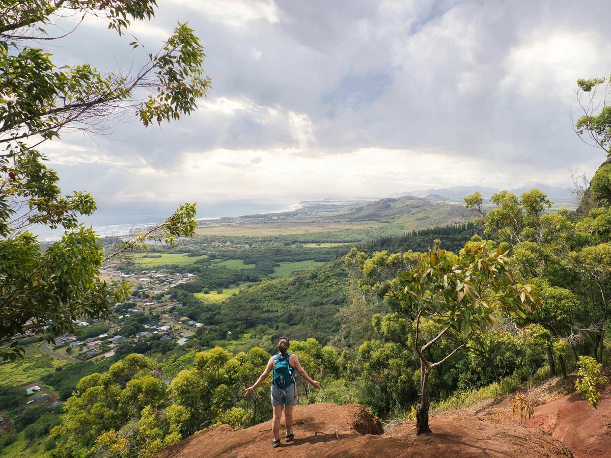
Over 90% of all of Kauai is best accessible on foot. Therefore, hiking is the ideal way to experience the entirety of Kauai. This makes perfect sense, then, why the island is nicknamed “the garden island.”
Suffice it to say, that hiking is a great way, if not the only way, to see all the sites and truly experience Kauai. Read on for some of the best hikes and trails to explore in the Kauai area.
Hiking Trails in Kauai at a Glance
- Kalalau Trail: Difficult, 22 miles round-trip, 5,000–6,500 ft elevation gain
- Maha'ulepu Heritage Trail: Easy, 4 miles round-trip, 300–400 ft elevation gain
- Hanakapiai Falls: Moderate, 7.6 miles, 2,381 ft elevation gain
- Waimea Canyon (The Canyon Trail): Moderate, 3.2–4 miles round-trip, 1,100 ft elevation gain
- Sleeping Giant (Nounou East Trail): Moderate, 3.6 miles, 1,000 ft elevation gain
- Awaawapuhi Trail: Difficult, 6.2 miles, 1,000+ ft elevation gain
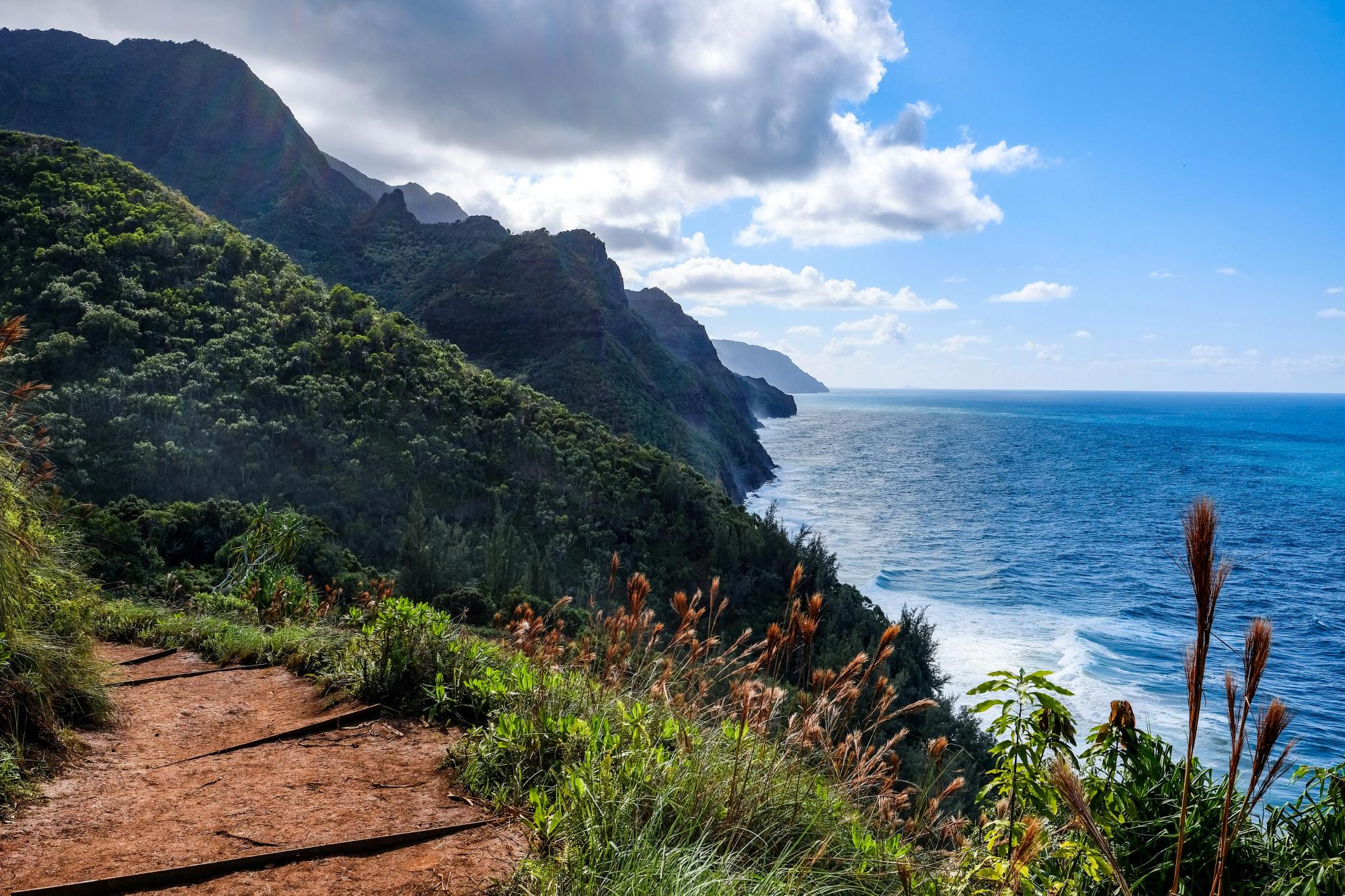
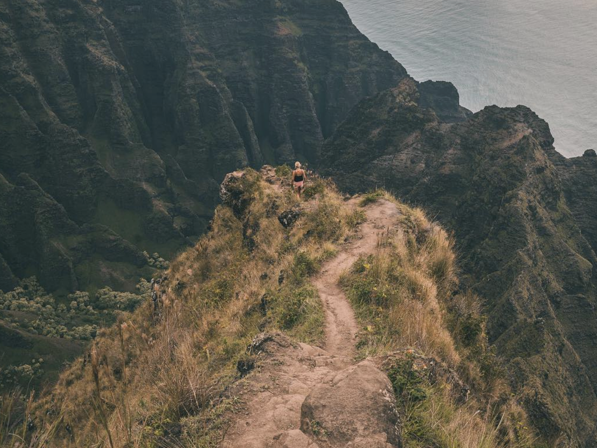
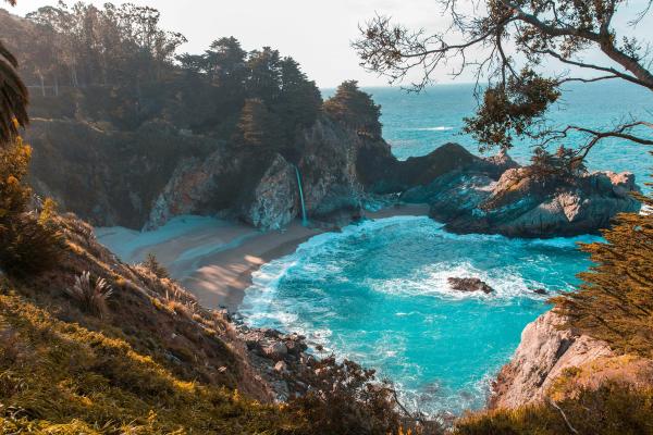
Kalalau Trail
Photo Credit: @haydenkortemoore
Difficulty: Difficult | Length: 22 miles round-trip | Elevation Gain: 5,000–6,500 ft
Get Directions to Kalalau Trailhead, Ke'e Beach, Ha'ena State Park
The Kalalau Trail is the only land route into the Na Pali Coast State Wilderness Park. Running 11 miles one way from Ke'e Beach to Kalalau Valley, it crosses five valleys and clings to steep volcanic cliffs with relentless elevation changes the entire way. The trail starts and ends near sea level but rises and falls dramatically throughout, making even the early sections more demanding than they first appear.
Here is what you can look forward to on the trail:
- Ocean views — Unobstructed Pacific panoramas from the clifftop sections between each valley, best in the stretch between miles 2 and 6 where the trail hugs the open ridgeline above the coast
- Waterfalls — Hanakapiai Falls drops roughly 300 feet into a rock pool; only visible up close if you take the full 8-mile valley spur past Hanakapiai Beach
- Wildlife encounters — Hawaiian monk seals resting on cove beaches, spinner dolphins visible from the cliffs, and native forest birds including the 'apapane and 'i'iwi in the valley interiors
- Wildflowers — Native naupaka shrubs along the coastal sections and native Hawaiian forest flora through each valley including hala, ohia lehua, and koa
- Sunset views — The exposed ridge sections between Hanakapiai and Hanakoa face west and catch full golden hour light over the Pacific
Once past the first two miles, you are in genuinely remote terrain with no services, no bail-out points, and conditions that can change without warning. Muddy stretches, flooded stream crossings, and exposed cliff paths are all part of the experience. A Hawaii State Parks permit is required to hike beyond Hanakapiai Beach, and advance reservations are required to enter Ha'ena State Park at all. If you want the Na Pali experience without the overnight commitment, the first two miles to Hanakapiai Beach are open for day use and deliver some of the most dramatic coastal scenery on the island.
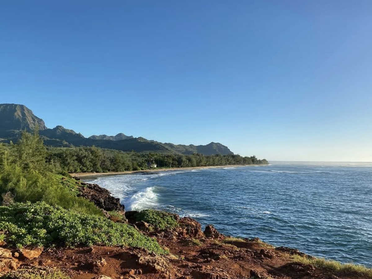
Maha'ulepu Heritage Trail (Coastal Trail & Cave Poipu)
Difficulty: Easy | Length: 4 miles round-trip | Elevation Gain: 300–400 ft
Get Directions to Shipwreck Beach Trailhead, Poipu
If you are looking for a trail that feels rewarding without demanding your entire day, the Maha'ulepu Heritage Trail is the one to add to your list. Starting at Shipwreck Beach near the Grand Hyatt Kauai, this trail follows the southern coastline through a mix of red clay, sandy paths, and lava rock. It alternates between flat stretches and short rocky climbs with a few steep drop-offs along the cliffside edge, making it a natural add-on to a full day rather than a standalone expedition.
You can expect to see and experience all of this along the way:
- Ocean views — Uninterrupted coastline views along the full length of the trail, with the clearest angles from the lithified dune cliffs in the first mile out of Shipwreck Beach
- Wildlife encounters — Hawaiian monk seals resting on the sand, green sea turtles feeding in the shallows, nesting seabirds on the cliffs, and humpback whales visible offshore from December through April
- Endless views — Sculpted lava formations, ancient coral and algae fossils embedded in the limestone cliff faces, and tide pools along the rocky sections between beaches
- Sunset views — The westward-facing cliff edge near Punahoa Point is a reliable sunset spot with open ocean horizon views
- Wildflowers — Native coastal shrubs including beach naupaka and low-lying dune plants throughout the sandy sections
The trail leads to Makauwahi Cave, the largest limestone cave in Hawaii and one of the richest fossil sites in the state, so aim to arrive early since it closes in the late afternoon. The path is not well-marked in places, so downloading the AllTrails map before heading out is strongly recommended. The trail is largely exposed, so an early start means cooler temperatures and the best chance of spotting wildlife before the beach crowds arrive.
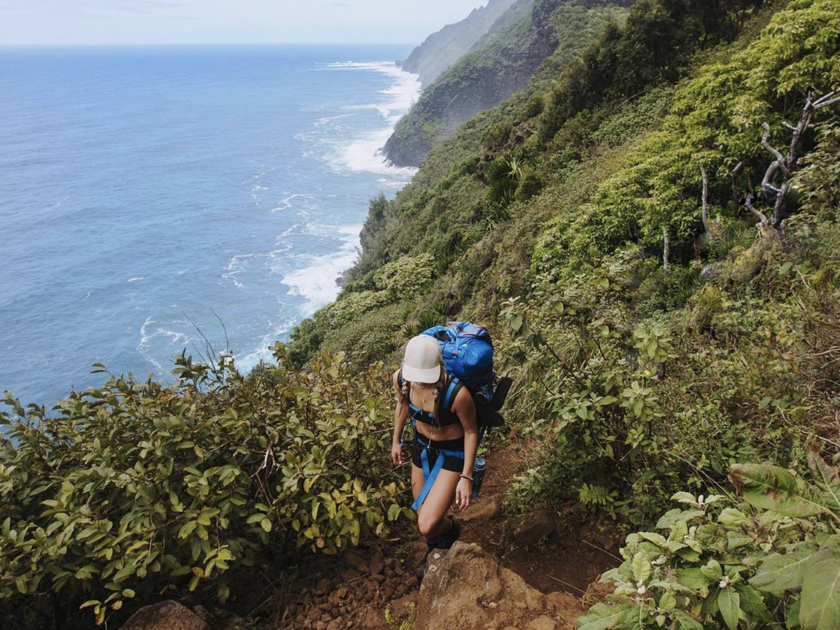
Hanakapiai Falls
Photo Credit: @roamingwiththereynolds
Difficulty: Moderate | Length: 7.6 miles | Elevation Gain: 2,381 ft
Get Directions to Hanakapiai Falls Trailhead, Ha'ena State Park
This is the trail for anyone who wants to earn their waterfall. Branching off the Kalalau Trail and following the Hanakapiai Valley deep into a narrow jungle canyon, the route is rugged and unmaintained beyond the beach, with fallen trees, slippery boulders, and a real flash flood risk after heavy rain. A Hawaii State Parks permit is required to hike past Hanakapiai Beach, and advance reservations are required to enter Ha'ena State Park.
What makes this trail worth every step:
- Waterfalls — Hanakapiai Falls drops 300 feet in a single unbroken plunge onto flat rocks at the valley floor; the best close-up view is from directly at the base, roughly 50 feet out, where the full cliff face fills your entire field of vision
- Wildflowers — Native valley plants including wild ginger, heliconia, and various fern species line the trail through the interior canyon
- Wildlife encounters — Native forest birds including the 'apapane, 'amakihi, and white-tailed tropicbird are frequently spotted in the canopy above the valley trail
- Endless views — Dense jungle canopy and narrowing valley walls create an immersive rainforest corridor unlike anything accessible on the coastal trails
Finish times range from four to over six hours depending on pace and conditions, so give yourself a full day and do not rush it. Budget at least two hours specifically for the waterfall section, as the terrain leading to the base is steep, wet, and unforgiving. Most hikers who make it to the falls say it is one of the most memorable moments of their entire trip to Kauai, and it is easy to see why once you are standing at the base.
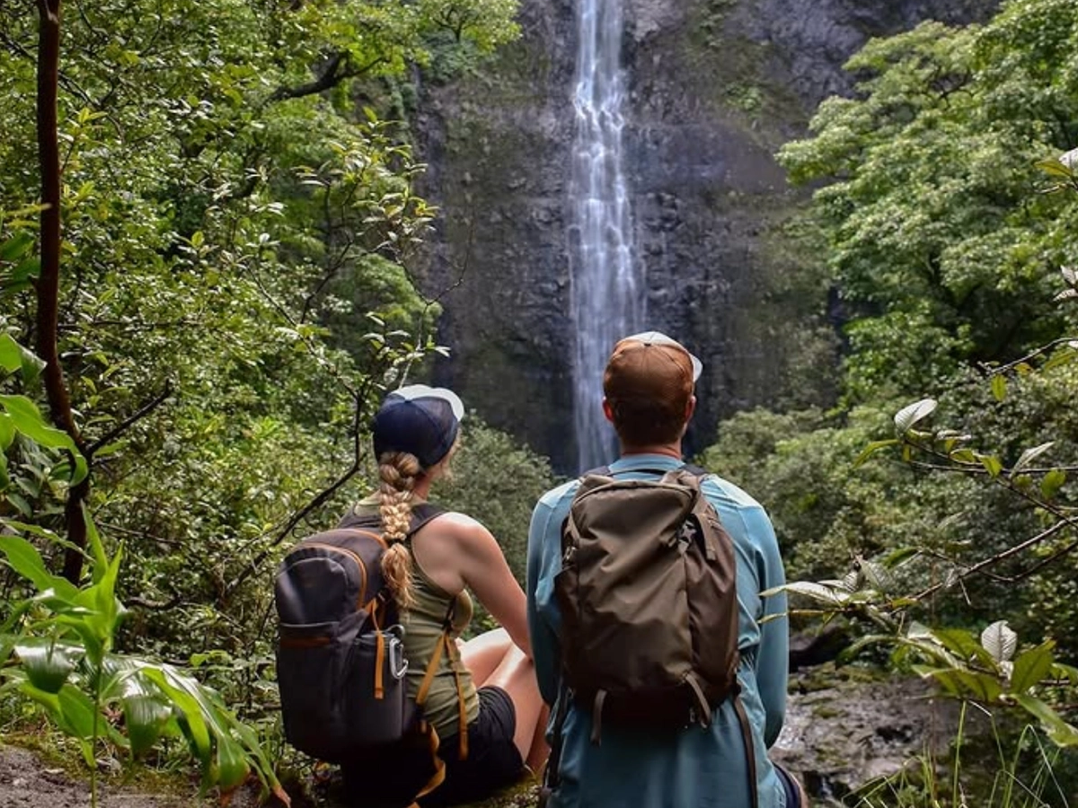
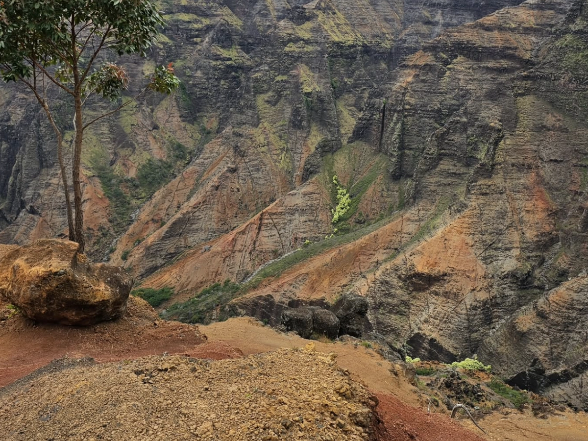
Waimea Canyon: The Canyon Trail
Photo Credit: @marthagonzalez05
Difficulty: Moderate | Length: 3.2–4 miles round-trip | Elevation Gain: 1,100 ft
Get Directions to Canyon Trail Trailhead, Pu'u Hinahina Lookout, Hwy 550
You have probably heard Waimea Canyon called the "Grand Canyon of the Pacific," and standing on its rim for the first time makes it clear why the comparison stuck. Waimea Canyon stretches over 2,500 feet deep and 10 miles long, with a geological layering of reds, greens, and browns that shifts dramatically with the light throughout the day. The Canyon Trail follows red sandy paths through Koke'e State Park forest before opening onto canyon rim viewpoints and ending at the top of Waipo'o Falls.
Here is what stands out most on this trail:
- Waterfalls — Waipo'o Falls drops 800 feet in two tiers on Koke'e Stream; the trail brings you to the top of the upper tier only, so stop at the Pu'u Ka Pele roadside lookout near mile marker 13 before you hike for the only angle where both tiers and the full drop are visible together
- Endless views — The canyon rim sections offer direct sightlines across the full width and depth of Waimea Canyon, with the red rock walls and layered geological strata most vivid in the late morning light
- Sunset views — The exposed western-facing rim catches direct late afternoon light that turns the red canyon walls deep amber and orange
- Wildlife encounters — Wild goats on the canyon cliffs, native Hawaiian forest birds in the Koke'e forest sections, and nene (Hawaiian goose) occasionally spotted near the trailhead area
- Wildflowers — Yellow ginger lining the Koke'e Stream near Waipo'o Falls, and native ohia lehua trees throughout the forested upper sections
The most scenic starting point is the Pu'u Hinahina Lookout parking lot between mile markers 14 and 15 on Highway 550, with the trailhead clearly signed from the lot. The trail can get extremely muddy after rain, with steep rocky drop-offs along the canyon rim requiring careful footing. Before you lace up, make a point to stop at the Pu'u Ka Pele roadside turnout near mile marker 13 on the drive up, as that is the only vantage point where you can see both tiers of the falls and the full drop together.
Sleeping Giant on the Nounou East Trail
Difficulty: Moderate | Length: 3.6 miles | Elevation Gain: 1,000 ft
Get Directions to Nounou East Trailhead, Haileilio Road, Wailua
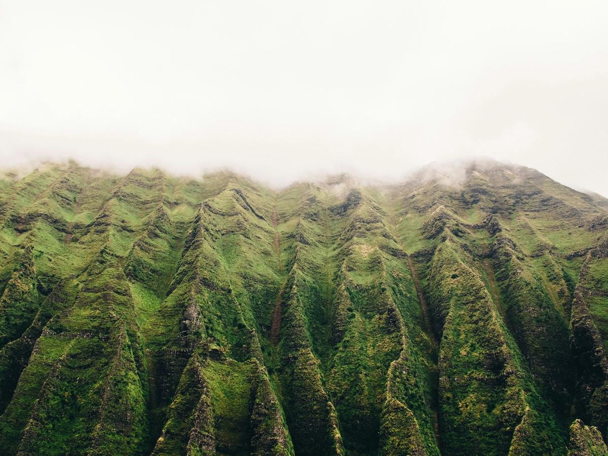
Even before you reach the trailhead, you can spot your destination from town. Nounou Mountain gets its name from the ridge's unmistakable profile, which, from Kapa'a, looks exactly like a giant lying flat on its back. Local legend holds that a giant ate so many rocks disguised as food at a feast that he lay down and never woke up, and once you see the mountain from the road, the story makes complete sense. The Nounou East Trail is the longest and most scenic of the three routes to the summit, climbing steadily through the shady forest of ironwood, guava, and silk oak before switch backing up to the chest and then the head.
The views from the top make every switchback worth it:
- Ocean views — The full Coconut Coast and Pacific spread out directly below the summit, with the coastline visible from Lihue in the south to the North Shore in clear conditions
- Endless views — Inland panoramas across the Wailua River, Kapa'a town, and the island's volcanic interior including the cloud-ringed peak of Mt. Waialeale, one of the wettest spots on earth
- Sunrise views — The east-facing summit catches first light directly over the Pacific, making this one of the most accessible sunrise hikes on the island; plan to arrive at the trailhead roughly 90 minutes before sunrise
- Wildlife encounters — Native and introduced forest birds throughout the ascent, including the red-crested cardinal, Japanese white-eye, and native 'amakihi in the upper canopy
- Wildflowers — Flowering native shrubs and low-lying coastal plants along the upper exposed ridge sections
The upper section is fully exposed, so bring sun protection and more water than you think you need, and expect a slick trail after rain. At the top, a picnic shelter on the giant's chest marks the main rest point, with views spreading across the Wailua River valley, the eastern coastline, and toward Mt. Waialeale crater on clear days. A short scramble beyond the shelter leads to the head, offering near 360-degree views for those sure-footed enough to take on the narrow ridge.
Awaawapuhi Trial
Photo Credit: @bindershots
Difficulty: Difficult | Length: 6.2 miles | Elevation Gain: 1,000+ ft
Get Directions to Awaawapuhi Trailhead, Kokee State Park, Hwy 550
If you only have time for one difficult hike on Kauai, make it this one. Starting at Koke'e State Park along Highway 550, the trail descends gradually through dense native forest before arriving at a narrow exposed ridgeline with sheer drops on both sides and an unobstructed view straight down into the cliff-walled Nualolo and Awaawapuhi valleys with the Pacific stretching out beyond. The overlook at the end is one of the most dramatic vantage points on the island and, at the right time of day, one of the finest places on Kauai to watch the sun drop into the ocean from elevation.
This is what you are hiking toward:
- Ocean views — A sheer 2,500-foot vertical drop directly to the Na Pali coastline from the ridgeline overlook, with the Pacific filling the entire horizon beyond the valley mouths
- Endless views — Layered green ridgelines of Nualolo and Awaawapuhi valleys visible simultaneously from the narrow endpoint, with no other accessible trail on the island offering this angle of the Na Pali interior
- Sunset views — The west-facing ridgeline overlook catches direct sunset light over the Pacific; the cliff walls turn gold and then deep red as the sun drops, making late afternoon the ideal time to arrive at the endpoint
- Wildlife encounters — Native Hawaiian forest birds including the 'apapane, 'oma'o, and pueo (Hawaiian short-eared owl) occasionally spotted in the Koke'e forest along the descent
- Wildflowers — Awapuhi wild ginger lining the trail throughout, particularly dense on the lower sections approaching the valley rim
Tree roots and mud make the trail tricky underfoot throughout, and the climb back out is more demanding than the descent suggests. Most hikers complete the round trip in around four hours, but give yourself time at the overlook rather than rushing back for the car. Cell service is unreliable beyond the trailhead, so download your maps before you set off.
Best Hikes in Kauai and Amazing Trails
Photo Credit: @ericjamesward
The above are six of the best hikes and trails in Kauai. Keep in mind, though, that nearly all of them demand a high level of experience and physical ability when compared to more mundane hikes and trails.
At The Parrish Collection Kauai, we recommend you check with local experts before starting out on any trail to ensure you are well-prepared. Otherwise, we encourage you to enjoy all the surrounding beauty on the “Garden Isle”.